A Walk for All Seasons: Taoyuan District's Hiking Trails
◎English written by Peng Hsin-yi
◎Photos courtesy of Pao Chung-hui
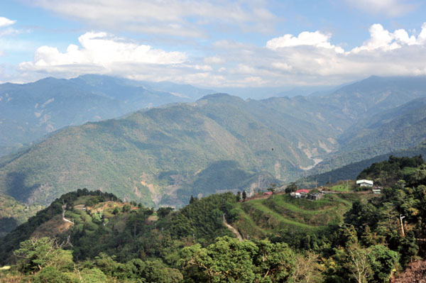
 Taoyuan District is located at the north tip of Kaohsiung. The district covers 929 square kilometers, but has 76 mountains and hills. Two-thirds of the district is between 500 and 1,000 meters above sea level. The elevation of the rest is over 1,000 meters. Most of the mountain areas are undeveloped, and the beauty of virgin forests evokes the feeling of visiting a dreamland, which is what "Taoyuan" means in Chinese.
The district's has around 4,500 residents, 90% of whom belong to the indigenous Bunun tribe. 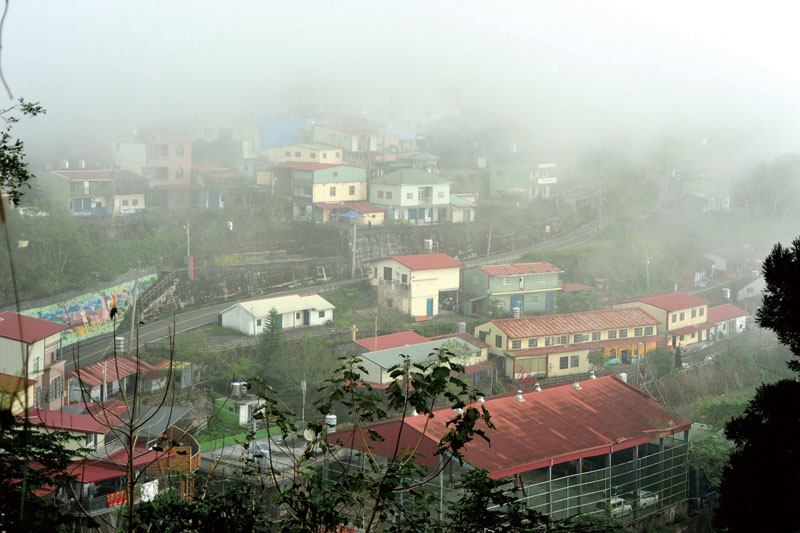 If you visit the district, you are likely to be greeted with a smile and a hearty "Wu Ni Nan Mi Hu Mi Sang," a blessing for travelers in the Bunun Austronesian language.
The most popular tourist attraction in the district used to be Tengjhih National Forest Recreation Area. Devastated by Typhoon Morakot back in 2009, it has recovered but because few people are aware of its reopening, tourists have yet to return in significant numbers. To draw people's attention,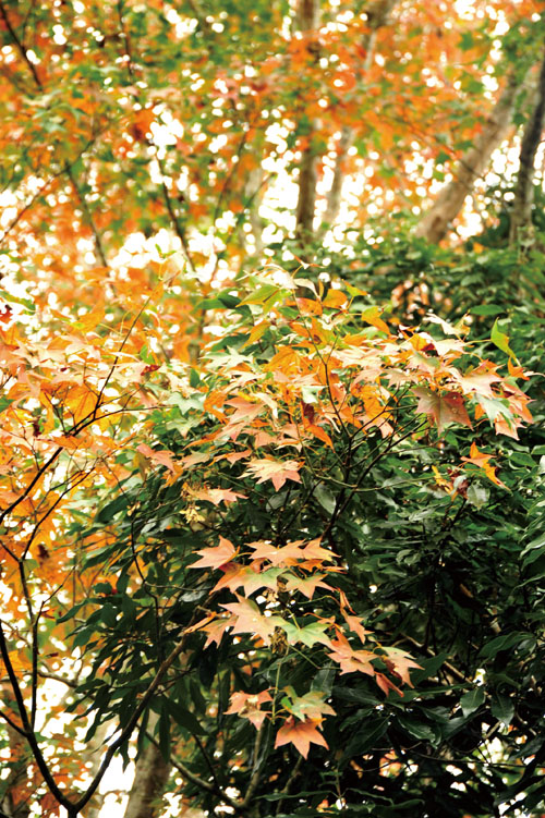 the district government has come up with some new activities. Since September 2013, a weekly holiday market has been held in the empty lot in front of Baoshan Elementary School, featuring aboriginal music performances, arts and crafts. The market is steadily gaining popularity.
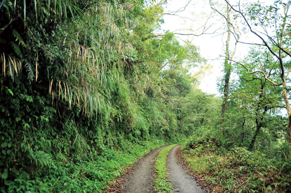
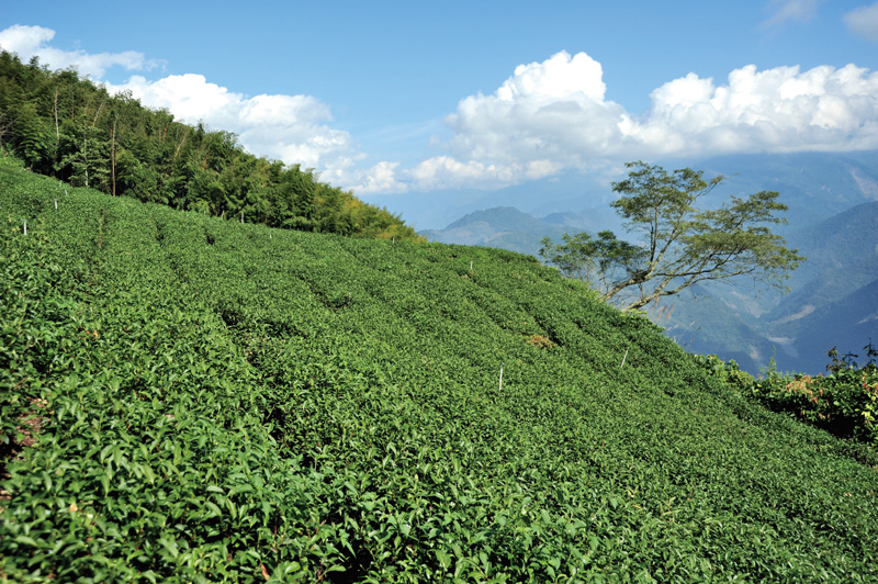
To further boost tourism, in 2012 the district built six hiking trails accessed from the main roads in the Baoshan, Tengjhih and Erjituan areas. Each trail showcases special scenery, and they are: Erjituan Wulong Tea Trail; Erjituan Calla Lily Trail; Erjituan Historic Site Trail; Erjituan Toujian Shan Coffee Trail; Erjituan Bunun Gathering Trail (also known as the Cherry Blossom Trail); and Baoshan Wild Tea Trail. These trails have been planned to connect local agriculture to tourism so that tourists are able to visit orchards and farms and enjoy hands-on experiences such as coffee harvesting while enjoying scenic hikes.
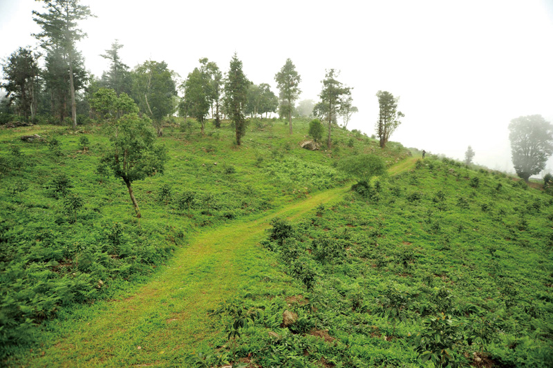
The Erjituan Wulong Tea Trail and the Erjituan Calla Lily Trail are the least demanding of the six trails, and suitable for the whole family.
Erjituan is located at an elevation of 1,500 meters. The place name actually means "two groups" in Chinese, and comes from the fact that the area's residents fall into two groups. Those in lower Erjituan are mostly surnamed Chen, and are mainly Roman Catholics; upper Erjituan residents, however, have the surname Lin, and are Protestant. Erjituan is surrounded by mountain mists year round; it looks like a scene taken straight from a landscape painting.
Ertituan Wulong Tea Tail is less than two kilometers long and is suitable for visitors in every season. Tea is harvested once every season, and tea is picked twice during the spring and winter harvests, so technically speaking, there are six harvests per year. This trail is especially fun during harvest time, but very enjoyable anytime of the year. Around every corner there is a new photo-worthy scene.
Erjituan Calla Lily Trail is a 2.5-kilometer-long winding trail bordered by calla lilies. The lilies are only a year old, but the landscape and climate of the area is friendly to this plant species, so they have already grown into thick, rich, emerald-green patches. Hiking along this trail and breathing in crystal clear air is very refreshing. If you visit during lily season (December to April), the blanket of pure white blossoms dancing in the breeze is a scene to feast your eyes upon.
 At the end of the Calla Lily Trail you come to Erjituan Historic Site Trail. High humidity gives this trail a blanket of green lichen, and nearby fruit and vegetable farms benefit from the climate. According to the development plan, flowers will be planted along the trail, so visitors will see a completely different scene when those are in place.
The Bunun Gathering Trail is also called the Cherry Blossom Trail because it has the best view of the mountain cherry blossoms which peak in late December. Between December and April, visitors can enjoy walking among pine and maple trees and green grass fields, and visit the two-hectare Cherry Blossom Park. The first Baoshan Cherry Festival was held on December 28, 2013. The festival included musical performances and a jogging event, so there was something for everyone to enjoy while admiring the mountain area's beautiful cherry blossoms.
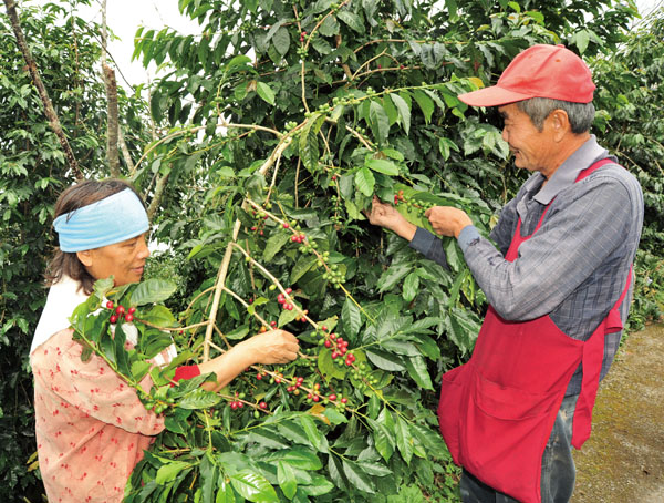
The most challenging trail among the six is Erjituan Toujian Shan Coffee Trail. It is best suited for experienced hikers or mountain climbers, who will pass coffee farms along the trail. In recent years, Taiwan's high-altitude coffee industry has gained momentum, and coffee farmers are now reaping their rewards. Hikers may detect a waft of coffee scent as they walk.
The best time to visit Baoshan Wild Tea Trail is between December and March. Depending when you come, you might see cherry, plum or peach blossoms. There are about eight hectares of plums and peaches along the trail. Blossoms peak in March, and seeing the mountains colored snow white by plum blossoms or pink by peach blossoms is an exceptionally lovely sight.
| |
For information about hiking trails:Baoshan Commnunity Develop Center
07-6893769
|
 四季皆宜 桃源區步道之旅
◎文/侯雅婷
◎攝影/鮑忠暉
位於高雄最北端的桃源區全區面積929平方公里,座落76座大小不一的山,令人嘖嘖稱奇!該區三分之二地區海拔一千至三千公尺,其餘地區海拔為五百至一千公尺,全區均屬高山區,有如世外桃源般的景致令人著迷,因而取名桃源區。
桃源區約有4500位居民,其中9成為布農族,踏進桃源區,居民臉上漾著笑意,以布農語Wu Ni Nan Mi Hu Mi Sang為造訪的旅人獻上誠摯地問候與祝福。
當地最受歡迎的藤枝國家森林遊樂區於2009 年莫拉克颱風來襲時,遭受重創,儘管桃源區持續建設,但外界不了解當地交通已暢通無礙因而怯步,讓人欣慰的是,2013年9月,桃源區每週六、日於寶山國小前方空地展演原住民音樂表演和舉辦假日市集,吸引遊客回到桃源旅遊。
 為了替當地觀光注入活水,2012年,桃源區在對外通聯道路通暢的寶山、藤枝和二集團開闢6條步道,分別為:二集團烏龍茶步道、二集團海芋步道、二集團遺址步道、二集團頭剪山咖啡觀光步道、二集團布農聚場步道(又名櫻花步道)以及野生茶步道。步道的規劃結合果園,讓旅人們漫步在森林中,還能體驗採收咖啡豆等實作課程,讓旅人們對當地農作有更深入的了解。
桃源區6條步道中,以二集團烏龍茶步道和二集團海芋步道路面最為平坦,是最合適闔家共遊的步道。
而二集團地名由來,海拔1500公尺的二集團居住兩大族群,下方的居民陳姓居多,信奉天主教 ;而上方居民林姓為主,信奉基督教,當地終日雲煙裊繞,像極了畫裏的山莊。
二集團烏龍茶步道長約1至2公里,是一整年都適合旅人造訪之地,茶葉一年四季各採收1次,再加上春茶和冬茶各可以採收2次,共採收6次。不論是否趕在茶葉採收期造訪,漫步在茶園中,眺望著另一個山頭,處處是風景。
二集團海芋步道長沿著彎延的山路栽植綿延2公里半的海芋,順應著當地地形和氣候,海芋步道呈現天然的潮濕環境,極適合海芋的生長,儘管海芋僅栽植1年,但肥厚的海芋綠意盎然,走在綠樹鬱鬱的步道,清新的空氣格外讓人感到心曠神怡,12月到4月為海芋花季,白色的海芋花搖曳地迎接造訪的旅人。
從海芋步道的另一端遠眺二集團舊遺址步道,只見舊遺址步道披覆綠衣,該區因水源豐沛,主要栽植高山蔬果,舊遺址步道計劃在2014年時,廣植花海呈現全然不同的風情。
 12月底山櫻花璀燦盛開,12月至隔年4月是最適合造訪二集團布農聚場步道的時節,眼前見到的盡是參天的松木和楓樹以及綠草如茵的草皮,轉個彎又是一番風景,感覺愛麗絲漫遊仙境的景致即將在眼前展開,這其中包括2公頃的櫻花公園,2013年12月28日桃源區首度舉辦「寶山櫻花季」,以音樂季和慢跑等形式讓櫻花的美麗烙印在旅人心中 。
二集團頭剪山咖啡觀光步道是6條步道中最具挑戰性的,屬專業登山步道。該步道栽植原生種咖啡,由黑轉紅的咖啡豆,代表了農人的辛苦有了回報,經過悉心的烘焙,咖啡的香氣在山間飄開來。
而寶山野生茶步道每年從12月中旬至隔年3月底,櫻花、梅花和桃花依時序綻放,野生茶步道梅花和桃花約有8公頃,花季為3月至4月,雪白的梅花和嫣紅桃花妝點滿山的璀燦花海。
| |
洽詢步道資訊:寶山里社區發展協會
07-6893769
|